Thunderstorm and rain warnings issued across UK as hopes of Indian summer fade
Thunderstorm and rain warnings have been issued across the UK, with hopes of an Indian summer this September beginning to fade.
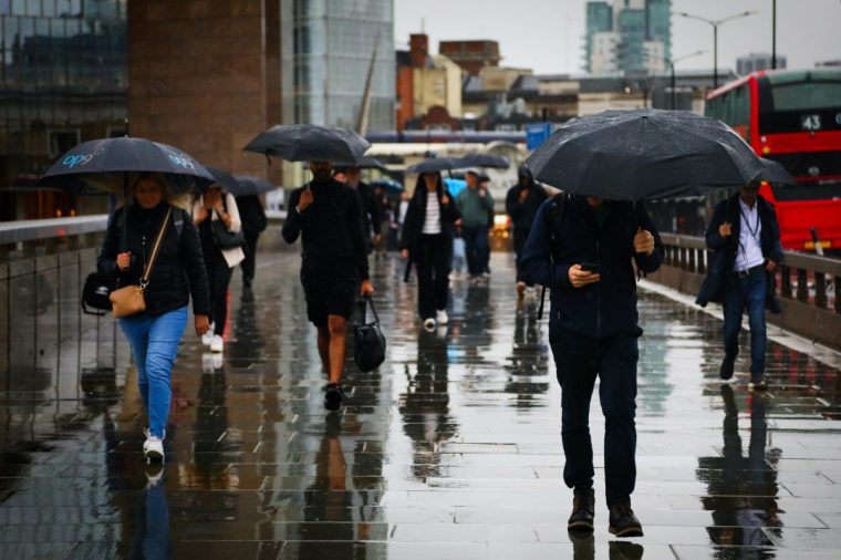
The Met Office has issued a yellow warning for thunderstorms from 11am to 8pm today, covering swathes of England and Wales.
Another yellow warning for heavy rain covering south-west England and much of South Wales has come into force until 2pm today, and a separate warning is in place until 9pm in parts of western Scotland.
The forecaster warned that heavy rain could cause “travel disruption and flooding in places”.
Monday marked a sharp end to the meteorological summer in the UK, with cooling temperatures and windy, rainy weather forecast for the rest of the month.
It comes after the warmest summer on record, with the UK’s mean temperature from 1 June to 31 August standing at 16.10°C, which is 1.51°C above the long-term meteorological average.
This topped the previous record of 15.76°C, set in 2018, and pushes the summer of 1976 out of the top five warmest summers in a series dating back to 1884.
But hopes of a spell of an Indian summer, characterised by unusually warm, dry weather in the autumn, have been dashed with the latest Met Office forecast.
A thunderstorm warning has been issued across southern England, the Midlands, parts of Yorkshire and southern Wales.
Read Next: Gales, thunder, and up to 40mm of rain as weekend washout kicks off autumnal shift
Rebekah Hicks, chief meteorologist at the Met Office, said: “We’re expecting a band of heavy rain and strong winds to move north-east through the first part of Wednesday, followed by heavy showers and the risk of thunderstorms. Some of these could bring hail and gusty winds, particularly in southern areas.
“Of course, the warning coincides with the first school run after the summer holidays for some, meaning a wet and potentially disruptive start to the day for many.”
Heavy rain and strong winds will move north-east from early on Wednesday, followed by heavy showers and some thunderstorms.
Conditions will gradually improve from the South West through Wednesday afternoon as showers become more isolated.
Rainfall totals will be 20-30mm across much of the area covered by the weather warning on Wednesday, but some places could see 40-60mm within a period of six to nine hours.
How long will the rain last?
Meteorologists have predicted that much of the UK will see a series of showers and longer periods of rain for the rest of September.
Next week is expected to see “unsettled” weather due to low pressure systems dominating, meaning heavy rain showers – particularly in the west and north.
Mid-September could see some drier weather and sunshine breaking through due to high pressure, Met Office forecasters said.
But low pressure is set to dominate again towards the end of the month, with unsettled weather conditions, showers, wind and longer spells of rain at times.
Temperatures are likely to be close to average, or slightly below overall, but may rise during any drier, sunnier spells.
Post a Comment for "Thunderstorm and rain warnings issued across UK as hopes of Indian summer fade"