Met Office issues yellow weather warning and Britain braces for heavy rain
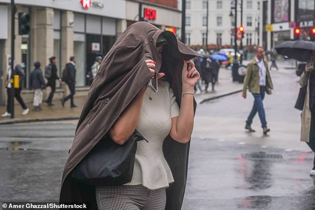
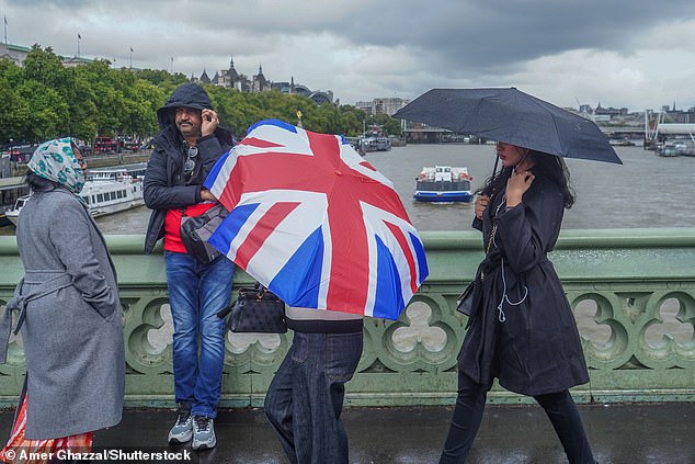
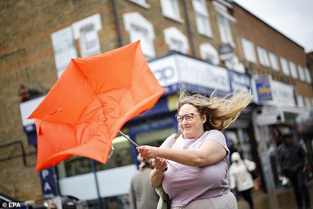
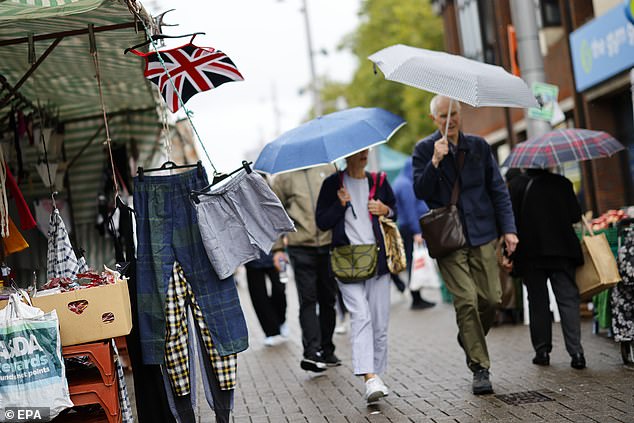
Britain is bracing for a stormy washout after a yellow weather warning was issued for heavy rain and strong gales, plunging the country into travel chaos with potential flooding.
The Met Office has warned of strong storms bringing hail, gusty winds and lightning with heavy bursts of showers set to unleash flash floods.
Britons have been warned that the grim weather could bring travel delays and power cuts as well as the possibility of properties flooding.
The alert comes days after remnants of Hurricane Erin rocked parts of Britain last week, after the Category 5 monster exploded in the Atlantic.
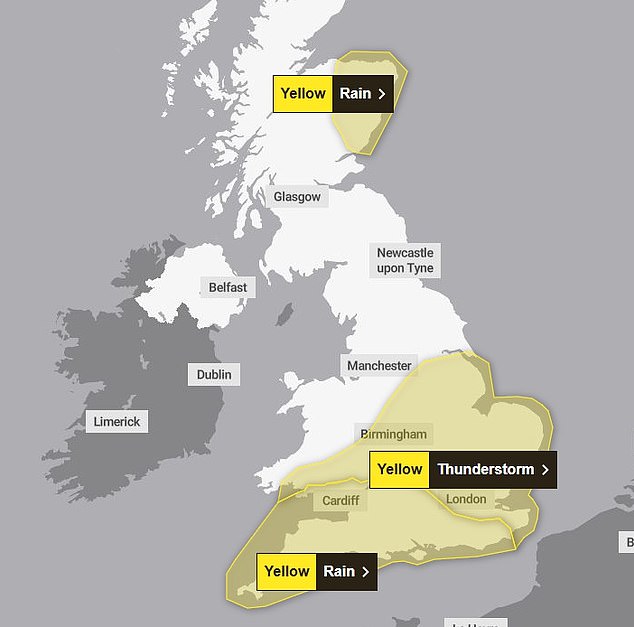
Gales are expected to rip through exposed western coastal areas, with the Met Office issuing a yellow weather warning for the south of England and eastern Scotland.
Powerful winds blowing in from the Atlantic are set to bring heavy rain, with up to 50mm expected to hit some parts of the country.
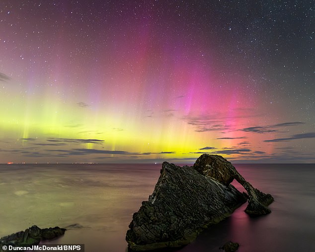
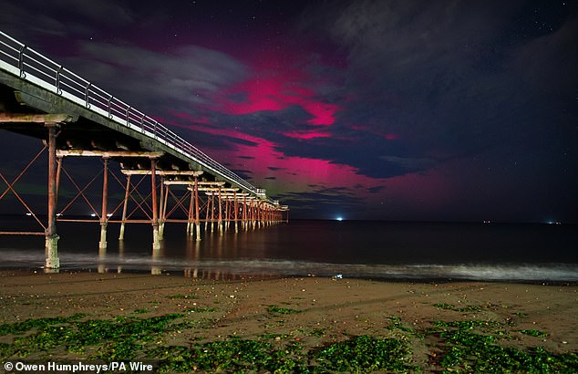
But it's not all been doom and gloom with skygazers treated to the dazzling Northern Lights this week.
Incredible images show the rare Aurora Borealis illuminating the sky across different parts of the country - including Northumberland, North Yorkshire, Whitby, Norfolk and parts of Scotland.
A fast-moving coronal mass ejection (CME) - a violent expulsion of charged material - left the sun 90 million miles away on Saturday night, bringing the Northern Lights to the UK this week.
It has brought an enhancement of geomagnetic activity, creating conditions that allow the aurora, to be visible further south than usual, provided that skies are sufficiently dark and clear.
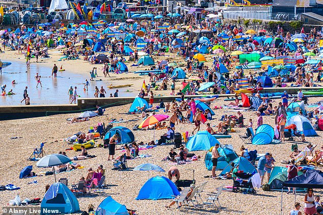
In stark contrast to the glowing aurora, Britons are also being warned to ready themselves for tempestuous weather, bringing an abrupt end to the nation's warmest summer on record.
Monday saw the end of meteorological summer with cooling temperatures, rain and wind expected across the country after the warmest summer on record.
In its warning, the Met Office said 'heavy rain may cause travel disruption and flooding in places'.
It added that 'some interruption to power supplies and other services is possible' and bus and train services will probably be affected with 'journey times taking longer'.
Rebekah Hicks, chief meteorologist at the Met Office, said: 'We're expecting a band of heavy rain and strong winds to move north-east through the first part of Wednesday, followed by heavy showers and the risk of thunderstorms. Some of these could bring hail and gusty winds, particularly in southern areas.
'Of course, the warning coincides with the first school run after the summer holidays for some, meaning a wet and potentially disruptive start to the day for many.'
Heavy rain and strong winds will move north-east from early on Wednesday, followed by heavy showers and some thunderstorms.
Conditions will gradually improve from the south west through Wednesday afternoon as showers become more isolated.
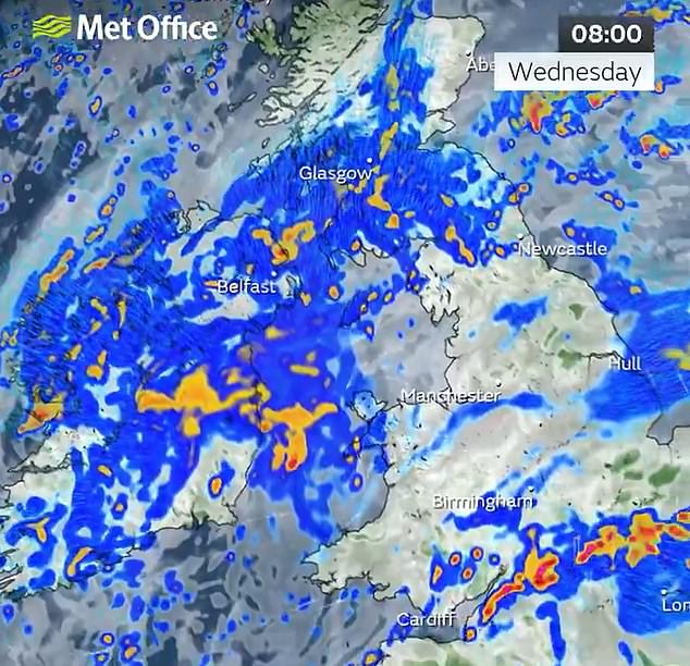
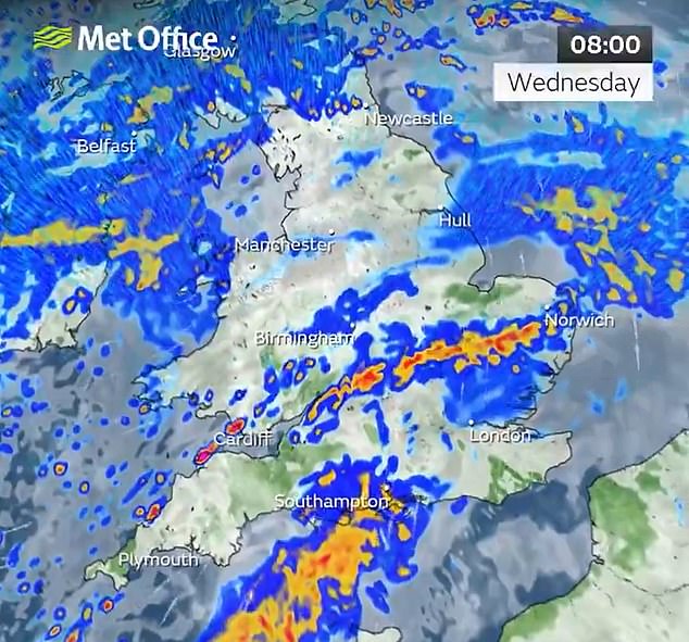
Rainfall totals will be 20-30mm across much of the area covered by the weather warning on Wednesday, but some places could see 40-60mm within a period of six to nine hours.
Coastal gales are also likely for a time, especially along English Channel coasts, the Met Office added.
The weather service said conditions on Thursday would be 'unsettled', with widespread showers and occasional thunderstorms.
Some sunny spells are expected, but rain may become more persistent in parts of western Scotland.
By Friday, southern areas will begin to see more settled conditions, with increasing sunshine and fewer showers. However, the North West will remain wet and windy, with a small chance of coastal gales, the Met Office said.
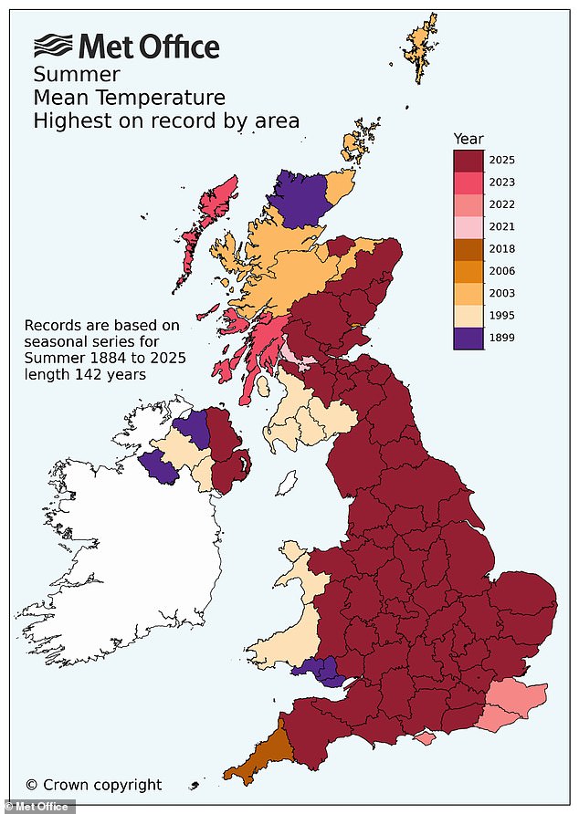
The weather service confirmed on Monday that this year's summer was the UK's warmest on record.
The mean average temperature across June, July and August was a provisional 16.10C, beating the previous seasonal high of 15.76C set in 2018.
It comes just months after the UK experienced the warmest and sunniest spring since data began.
The back-to-back record-breaking seasons have brought long spells of dry and hot weather for many across the country, but have taken their toll on the environment and agriculture, leading to hosepipe bans, drought orders, poor harvests and low water levels in reservoirs.
The new record pushes the summer of 1976 out of the top five warmest summers in a series dating back to 1884.
Instead, all five warmest summers have now occurred since 2000.
'Provisional Met Office statistics show that summer 2025 is officially the warmest on record with a mean temperature of 16.10°C, surpassing the previous record of 15.76°C set in 2018,' said Dr Emily Carlisle, Met Office scientist.
'The persistent warmth this year has been driven by a combination of factors including the domination of high–pressure systems, unusually warm seas around the UK and the dry spring soils.
'These conditions have created an environment where heat builds quickly and lingers, with both maximum and minimum temperatures considerably above average.'
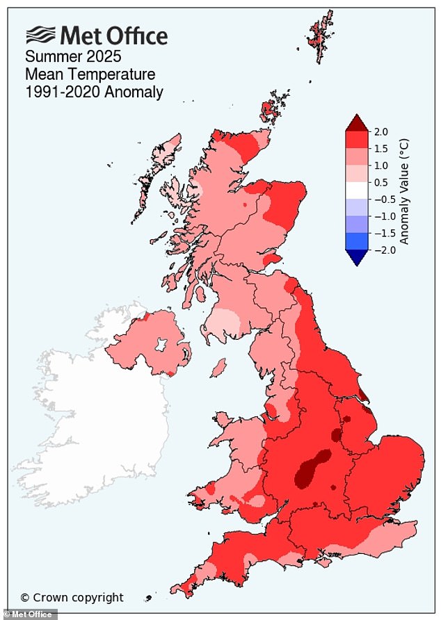
The five warmest summers in the UK are now 2025 (16.1C), 2018 (15.76C), 2006 (15.75C), 2003 (15.74C), and 2022 (15.71C).
The hot weather started back in June, which was the warmest on record in England.
July continued the trend, coming in as the UK's fifth warmest July in history.
In total, there have been four heatwaves throughout summer, although each has been relatively short–lived.
Read more- Will summer 2025 blaze its way to become the UK's hottest ever recorded with its sizzling 34.7C heatwave?
- Will Britain, enduring its fourth burning heatwave, make 2023 the hottest year on record with 79 scorching days above 20°C?
- Why is the UK on high alert as soaring temperatures hit 32C in London, marking the hottest day of 2025?
- Is Britain basking in unprecedented warmth as experts warn of the even hotter days looming?
- Is the warmest summer in UK history leaving a legacy of environmental havoc and severe drought dilemmas?
Post a Comment for "Met Office issues yellow weather warning and Britain braces for heavy rain"