Britain set for glorious Bank Holiday as mercury hits 30C - before Hurricane Erin barrels into UK
Britain is set for glorious Bank Holiday sunshine with temperatures up to 30C before remnants of Hurricane Erin hit.
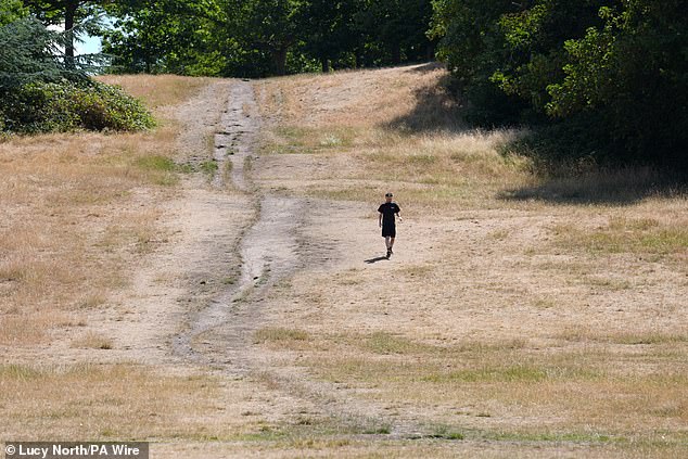
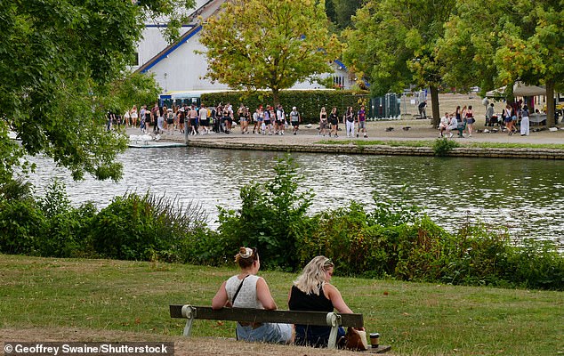
The country is braced for a weekend of sunshine and soaring temperatures, peaking at 30C on Monday, before rain and unsettled weather next week.
The RNLI has urged people to stick to lifeguarded beaches and stay cautious of rough seas.
Saturday will see a mix of cloud and sunshine, with some showers in Northern Ireland, western Scotland, and north-west England. Maximum temperatures are expected to reach 24C.
Sunday should be slightly warmer, with more sunshine across the country, though a few showers may affect northern and western Scotland.
Monday is set to be the hottest day, with widespread sunshine and temperatures hitting 29C to 30C.
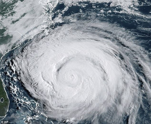
The fine weather is expected to end after Monday as Hurricane Erin's remnants bring rain and unsettled conditions across the UK.
Met Office meteorologist Craig Snell said: 'It's looking fairly fair, it's going to turn increasingly warm, the warmest day is going to be Monday.
'Each day there will be more sunshine developing.'
Chris Cousens, RNLI water safety lead, said: 'We want people to enjoy the bank holiday and stay safe, and with this unusually big surf forecast for this time of year likely to peak later in the bank holiday weekend and early next week, it's important for people to be aware so they can keep themselves and their families safe.
'Big surf means greater risk from rip currents, and the swell also coincides with spring tides, which means more powerful tidal water movement at greater speed.
'The forecast is changeable, so things might look different over the next couple of days.
'But we do know that with the current forecast for bigger waves building and arriving towards the end and the day after the August bank holiday weekend, beaches are likely to be busy with holidaymakers and locals.
'Some places could see bigger waves building through the weekend too.
'We always advise people to visit a lifeguarded beach where possible - but we also appreciate people will be out on the coast where lifeguards are not present.
'Rip currents are powerful channels of water that become more powerful in larger surf.
'They are also found around river mouths, estuaries and man-made structures like piers and groynes.


'Our rip current advice is the same whether you are at a lifeguarded beach or not. If you find yourself caught in a rip current don't fight against it or you'll get exhausted.
'If you can stand, wade back to shore, or swim parallel to the beach until you're free of the current, then return to the beach. Alternatively, if you can't do either of those or are becoming exhausted, Float to Live to preserve your energy and then wave and shout for help.'
Hurricane Erin, now ranked Category 2, is expected to generate large breaking waves of 8 to 16ft and life-threatening rip currents along the eastern coast of the US through Friday evening.
Met Office meteorologist Tom Morgan said that it is 'too early' to provide specific details about which regions will experience the windiest and wettest weather.
However, he warned that 'it will gradually turn less hot and be more generally changeable' as a result of Hurricane Erin, with thundery showers expected from Wednesday and 'more especially' on Thursday and Friday next week.
Western coastal areas are expected to be impacted by the large waves.
While this may be welcomed by surfers, the Met Office said that they 'could also pose hazards for beachgoers and coastal communities'.
Read more
Post a Comment for "Britain set for glorious Bank Holiday as mercury hits 30C - before Hurricane Erin barrels into UK"